


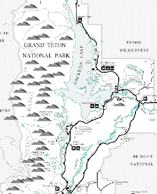
| Grand Teton NP Photomap
In our first two travel location articles we have introduced the concept of geotagged photosites to the Luminous Landscape readers. Geotagged photosites allow you to easily find a photo location and plan your route to it . This month we are introducing the concept of the online photomap. A photomap is an interactive map of significant photo locations in a given area of interest. Each site is represented by an animated camera icon. Clicking on the icon will lead you to that photosites geotagged web page. Our first photomap will be of an area dearest to my heart, Grand Teton National Park. Located in my home state, it is in many ways a nature photographers promised land. The Grand Teton NP photomap is intended to help you previsualize your photo ops, select your gear and find your route to the sites. Click on the image on the right to proceed to the newest version of the photomap. |
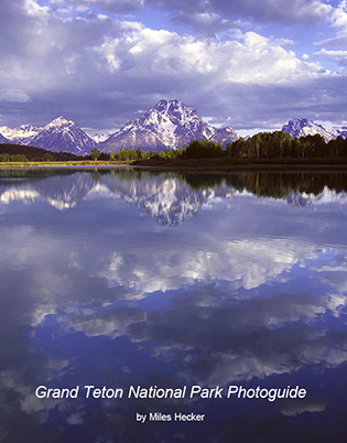
Grand Teton NP Photoguide PDF
One step above the online photomap is our photoguide PDF.
This downloadable version of the Grand Teton NP Photomap is called the Grand Teton NP Photoguide. It is a greatly enhanced and expanded version to help you plan and enjoy your phototrip.
Click on the image on the left to learn more about this version.
Miles has been involved with photography for over forty years. He teaches digital photography at Casper College in Casper,Wyoming. His photos have won awards fromNatures Best magazine,Photo.net, The Luminous LandscapeandWyoming WIldlife . Miles’ photos have been published in American Vignette, Backpacker Magazine, Natures Best Images, Popular Photography, Wyoming Audubon, and Wyoming Wildlife. He is co-founder ofWyoFOTO LLC.
Geotagged Photolocation Index
January, 2011


Elevate Your Vision


Read this story and all the best stories on The Luminous Landscape
The author has made this story available to Luminous Landscape members only. Upgrade to get instant access to this story and other benefits available only to members.
Why choose us?
Luminous-Landscape is a membership site. Our website contains over 5300 articles on almost every topic, camera, lens and printer you can imagine. Our membership model is simple, just $2 a month ($24.00 USD a year). This $24 gains you access to a wealth of information including all our past and future video tutorials on such topics as Lightroom, Capture One, Printing, file management and dozens of interviews and travel videos.
- New Articles every few days
- All original content found nowhere else on the web
- No Pop Up Google Sense ads – Our advertisers are photo related
- Download/stream video to any device
- NEW videos monthly
- Top well-known photographer contributors
- Posts from industry leaders
- Speciality Photography Workshops
- Mobile device scalable
- Exclusive video interviews
- Special vendor offers for members
- Hands On Product reviews
- FREE – User Forum. One of the most read user forums on the internet
- Access to our community Buy and Sell pages; for members only.
You may also like