


|
||
|
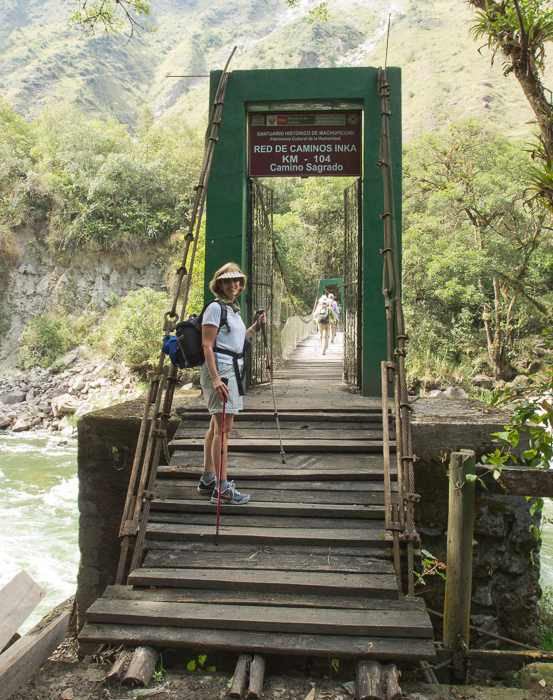
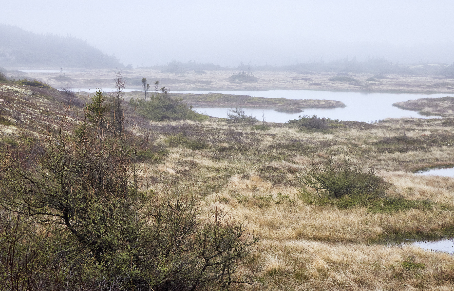
The one day Inca Trail hike begins at KM104 on the train right of way that runs to Aguas Calientes. This spot can only be reached by rail. The train ride may be booked either from Cusco or Ollantaytambo. The trek is approximately 6 miles in length, and can take anything between 5 to 8 hours depending on your walking pace and the length of time you spend at the sites en-route. The main obstacles are the 2000 foot elevation gain and the altitude of the Sacred Valley. If you don’t come from a high altitude region, two to three days of acclimation in Cusco or the Sacred Valleybefore hikingthe trail will prevent altitude sickness from creeping up on you and will make the trek a good deal easier. About 2-3 hours and 2000 feet of elevation gain after you begin your trek at Km104 you turn a corner and Wiñay Wayna comes into view. This Inca site was discovered by the Wenner Gren Scientific Expedition to Hispanic America, which investigated both archaeological sites and native Andean peoples in 1940-42 |
Click on image for more information
Click on image for more information
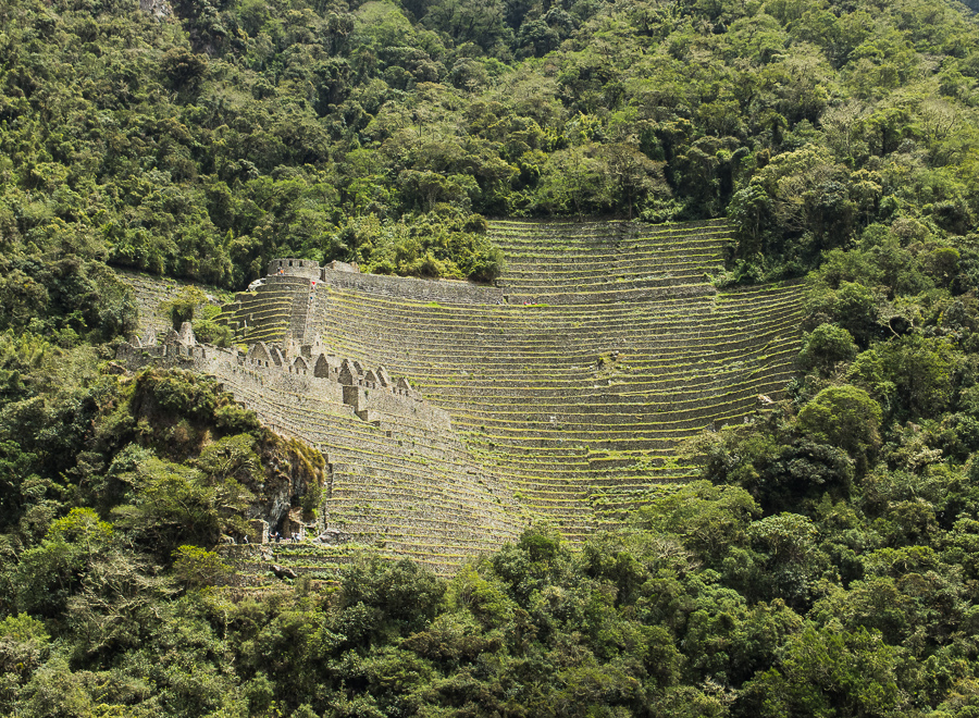
The name Wiñay Wayna was subsequently given to the ruin by the eminent Peruvian archaeologist, Dr. Julio C. Tello. Winay Wayna translates form Quechua as “Forever Young.” Often overlooked by travelers in the valley floor more keen on reaching Machu Picchu, the ruins of Winay Wayna, when seen from below, appear like an ancient stone castle atop a huge terraced garden. Low stone walls surround triangular inner walls, all of which create a maze of intriguing structures atop an ancient, tiered mountainside.
The ruins consist of upper and lower house clusters, interconnected by a long, precipitous staircase with accompanying fountain structures, often referred to as “baths. A large area of presumably agricultural terraces lies just north of the house-staircase complex.
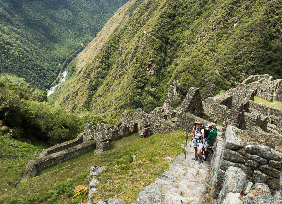
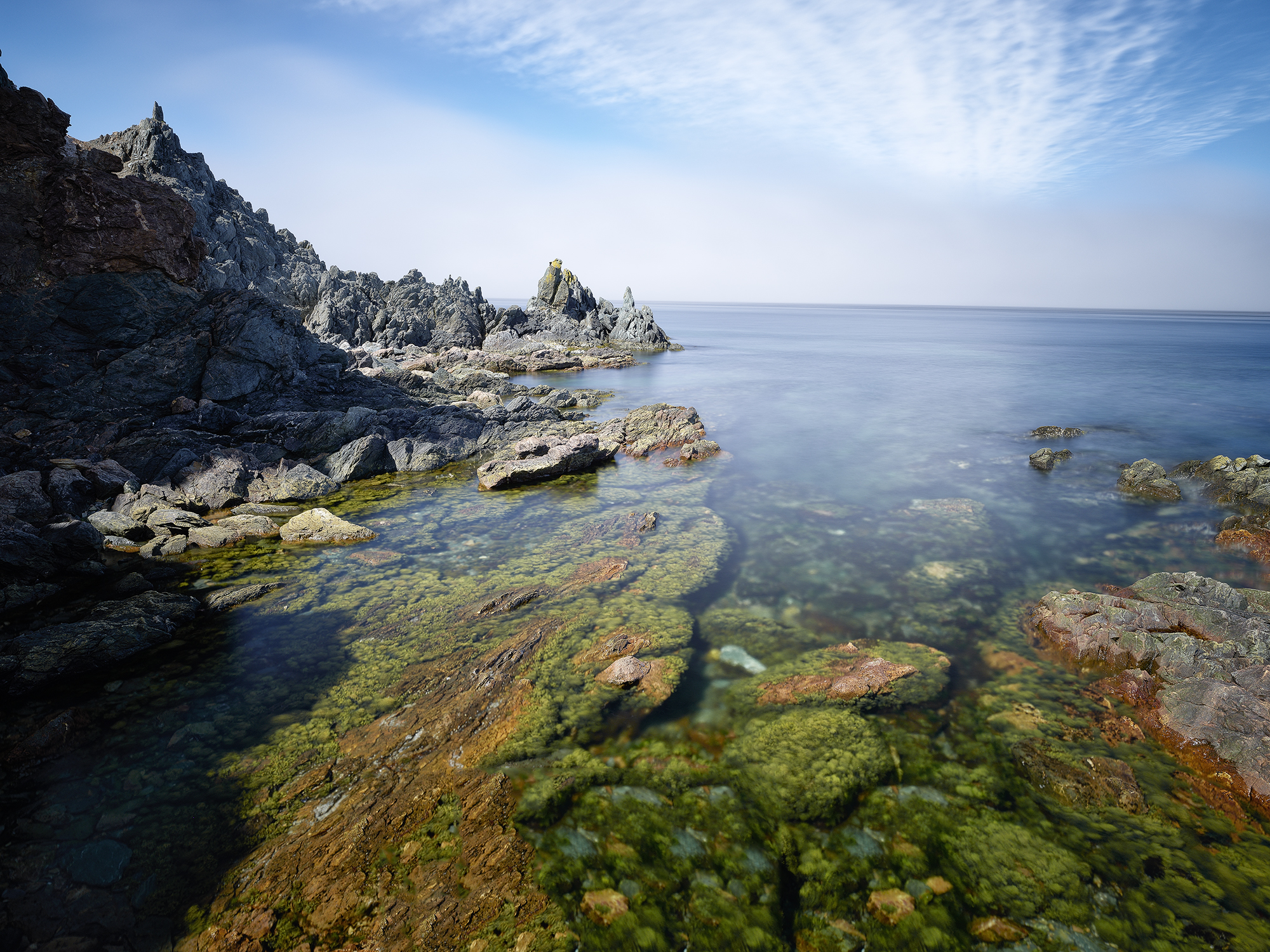
You continue a bit further on the trail passing under a lovely waterfall. You then begin the magnificent climb up through the ruins. The view here is stunning. I feel it is only surpassed on the trail by the citadel of Machu Picchu itself.
After you leave Wiñay Wayna the trail undulates along below the crest of the east slope of the mountain named Machu Picchu. It is relatively flat until you approach the Sun Gate. The steep stairs leading to Intipunku (sun gate) are reached after approximately 1.8 miles (3km). After somewhat of a grunt ascending these steps, you pass through the Sun Gate at the crest of the ridge. Here the citadel of Machu Picchu and the towering pinnacle Huanyna Picchu which sits behind it finally appear below you.
If you were an Inca coming from Cusco in the 16th century, this would be the end of a 5 day trek. For the day hiker it signals the end of an amazing day. From the the Intipunku it’s a short easy hike along the trail to the ruins. If you are lucky, you can photograph the citadel from the west side of the terraces in the golden rays of the late afternoon sun. If it’s overcast you can wander about and plan your next day’s shoot before descending to Aquas Calientes for a well earned dinner.
If you spend the night in Aquas Calientes and wake up early, you can take the first bus up to Machu Picchu before sunrise. If the clouds part, and the gods smile upon you, the magic spectacle of Machu Picchu touched by the clouds and lit by the early morning rays will present itself before you. Photographically speaking, life doesn’t get much better than this.
If you would like to find out more about photography in the Sacred Valley and Machu Picchu area, check out our newSacred Valley Photoguide.

Click on image for more information

About Miles Hecker
Miles has been involved with photography for over forty years. He teaches digital photography at Casper College in Casper,Wyoming. His photos have won awards fromNatures Best magazine,Photo.net, The Luminous LandscapeandWyoming WIldlife . Miles’ photos have been published in American Vignette, Backpacker Magazine, Natures Best Images, Popular Photography, Wyoming Audubon, and Wyoming Wildlife. He is co-founder ofWyoFOTO LLC.
Geotagged Photolocation Index
August 2013


Elevate Your Vision


Read this story and all the best stories on The Luminous Landscape
The author has made this story available to Luminous Landscape members only. Upgrade to get instant access to this story and other benefits available only to members.
Why choose us?
Luminous-Landscape is a membership site. Our website contains over 5300 articles on almost every topic, camera, lens and printer you can imagine. Our membership model is simple, just $2 a month ($24.00 USD a year). This $24 gains you access to a wealth of information including all our past and future video tutorials on such topics as Lightroom, Capture One, Printing, file management and dozens of interviews and travel videos.
- New Articles every few days
- All original content found nowhere else on the web
- No Pop Up Google Sense ads – Our advertisers are photo related
- Download/stream video to any device
- NEW videos monthly
- Top well-known photographer contributors
- Posts from industry leaders
- Speciality Photography Workshops
- Mobile device scalable
- Exclusive video interviews
- Special vendor offers for members
- Hands On Product reviews
- FREE – User Forum. One of the most read user forums on the internet
- Access to our community Buy and Sell pages; for members only.
You may also like